Amazonas (Estado Amazonas)
 |
 |
Amazonas has Venezuela's highest proportion of indigenous peoples of Venezuela; these make up only around 1.5% of the population nationwide, but the proportion is nearly 50% in Amazonas.
Amazonas is a word of Greek origin that was identified with a race of female warriors who lived in the Asian Sarmacia, beyond the Caucasus.
The name was assigned to the state on June 2, 1856 in honor of the Amazon River, which was discovered by Francisco de Orellana in 1542. He also attributed the name to the river as a result of a legend about a female tribe that tenaciously resisted the Spanish conquerors that reminded him of the Greek legend.
The Amazon River does not pass through the State, but a part of the territory is covered by the Amazon, through the Río Negro (Black River).
Map - Amazonas (Estado Amazonas)
Map


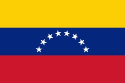
Country - Venezuela

Currency / Language
| ISO | Currency | Symbol | Significant figures |
|---|---|---|---|
| VES | Venezuelan bolÃvar | BsS. or Bs. | 2 |
| ISO | Language |
|---|---|
| ES | Spanish language |